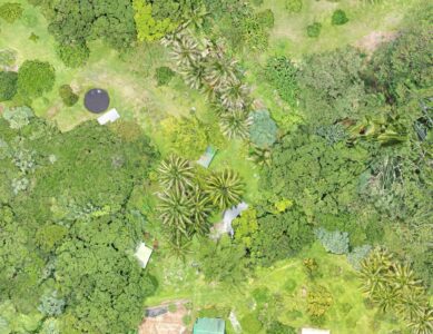
It was very educational to see how easily a property can be mapped with high resolution digital photography, in this day in age. My hanai son Kanoa came over with his DJI drone and a video-game-like controller that attaches directly to his smartphone. He had prepared by uploading property location data from the property tax website. The software basically takes it from there. Kanoa launched the drone, and it proceeded to grid the property according to a pre-determined algorithm, in order to take a long series of photos to be later stitched together.
We had gone to all the property pins weʻd been shown by the owner, and marked them with white buckets. This would allow us to draw precise boundary lines once the orthomosaic was loaded into our design software, because the property tax website overlay is always a bit inaccurate. Sure enough, once Kanoa had rendered the image and sent it to us (a giant, 393Mb file), we were able to see the property in exquisite detail. We actually had to reduce the file size in order to make it manageable in our chosen open source design program, InkScape. We worked pretty hard for a couple of weeks to create layers and fill in much of the detail of the resources that currently exist on the property. But, some of the most valuable use of this system is to determine locations and spacing for future plantings.
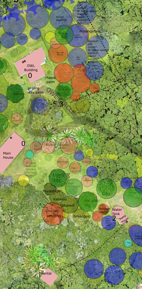
Below, is a screenshot of maybe 2.5 acres of our project. You can see that weʻve been able to add layers to represent existing plants, boundaries, trails, roads, and structures. A couple of layers, like ʻunderground infrastructureʻ and ʻpermaculture zonesʻ are turned off. You can also see that weʻve determined locations for trees that have not yet been planted (unlabeled). At our weekly permaculture design meetings, weʻll be referring to this map and refining our decisions about which plants go where, according to permaculture principles.